


Park Hill

The short answer
Park Hill is in northeast Denver, east of City Park, and it spans three official neighborhoods: South Park Hill, North Park Hill and Northeast Park Hill. This guide covers all three. Homes are mostly older, including Tudors, Denver squares, brick bungalows and larger estates, with mid-century houses too. I-70 connects the area to the airport and the mountains, and the closest stations on RTD's airport rail line are outside it, at 40th & Colorado and Central Park.
Watch: Jimmy's video on this area
What is living in Park Hill like?
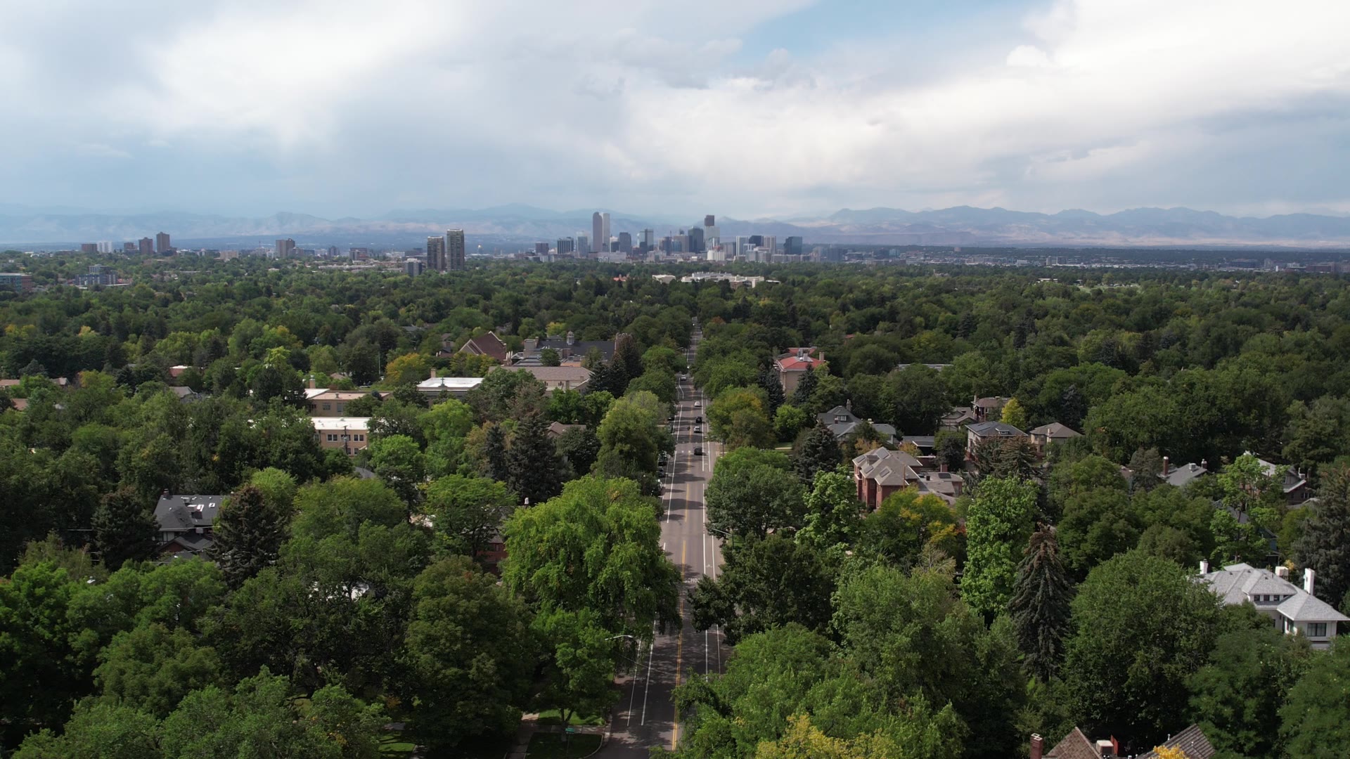
Park Hill feels to me like a small town inside this big city, and parts of it remind me of living on the East Coast. The streets are wide and tree-lined, and parkways run with greenery down the middle. South Park Hill has bigger homes and lots, along with mature trees and wide sidewalks, and it sits closer to City Park. You're near City Park, the Denver Zoo and the Denver Museum of Nature & Science. Walkability is moderate, and some areas have shops or a cafe within reach.
Neighborhood organizations are active here. Greater Park Hill Community, a volunteer-based registered neighborhood organization, publishes the Greater Park Hill News and sponsors an annual home tour.
Get the names straight first. Greater Park Hill is made up of three official statistical neighborhoods, and this guide covers all three. Montview Boulevard, the listed parkways and the National Register area run through South and North Park Hill. Park Hill Park and Dahlia Square are in Northeast Park Hill. If you're still choosing a part of the metro, start with the Denver relocation guide.
What draws people here
- The parkways. Montview Boulevard, Forest Street Parkway, Monaco Street Parkway and East 17th Avenue Parkway are all on the National Register of Historic Places.
- Range in older houses. The National Register area alone holds Foursquare, Bungalow, Tudor Revival and Spanish Colonial Revival designs.
- City Park next door. It sits directly across Colorado Boulevard from South Park Hill.
- A new city park. Park Hill Park covers 155 acres and is Denver's fourth-largest park, open in its current state as of August 2026.
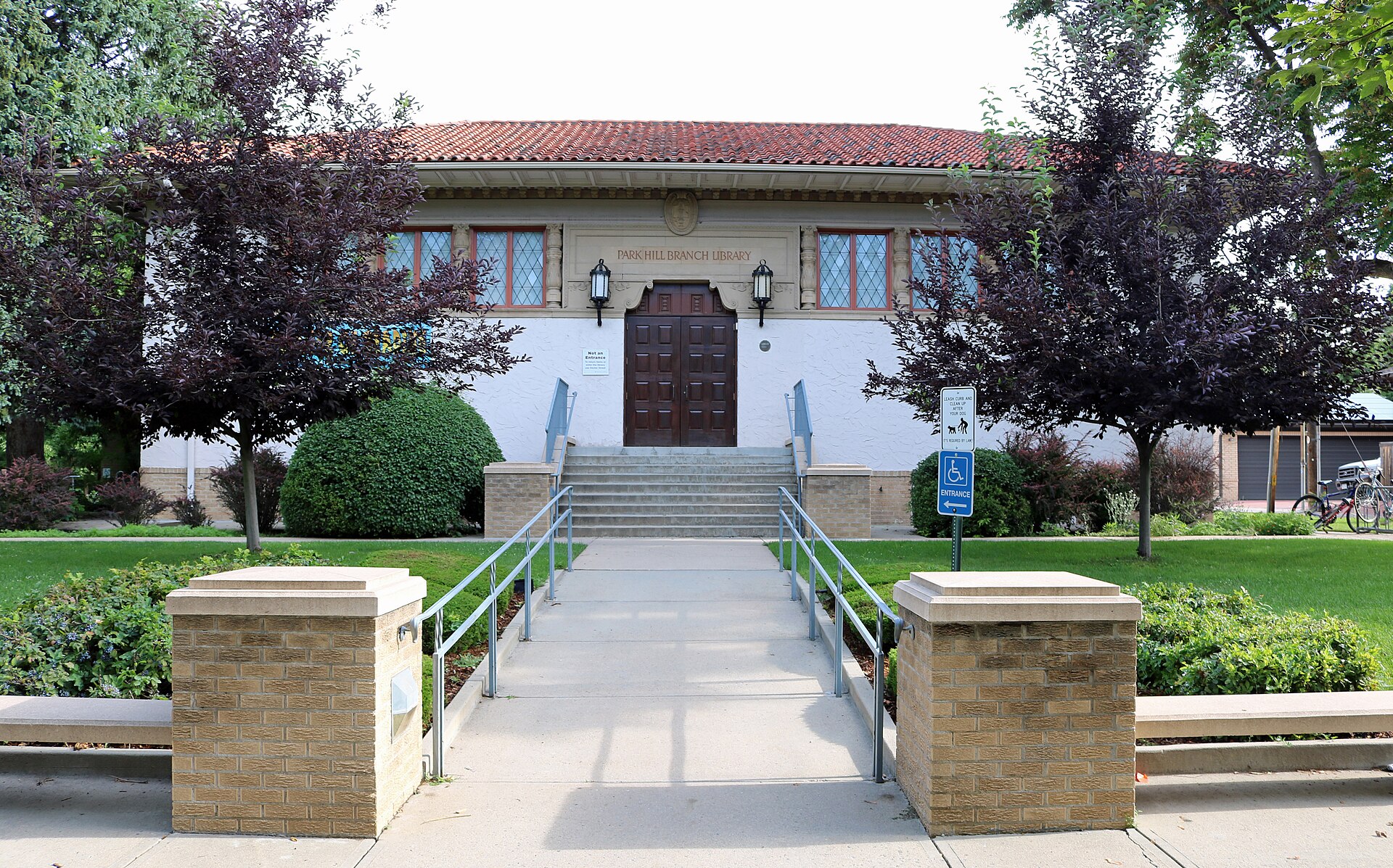
- A landmark library. The Park Hill Branch at 4705 Montview Blvd. is a Carnegie-funded building and a Denver landmark.
What gives people pause
- Home age. Buildings in the National Register area go back to about 1893. That can mean old sewer lines, water lines and foundations, so build your inspections around it.
- Moderate walkability. Map what's near the specific address.
- Rail isn't close. There's no RTD rail stop inside Park Hill.
- Historic labels. A National Register listing and a Denver landmark designation are different things, and they carry different rules.
- Park Hill Park's work is still ahead. As of October 2026, the city's timeline puts construction in 2028, and its vision proposes stormwater work to prevent flooding. Check the flood map for addresses near the site.
Where is Park Hill, and how do you get around?
Colorado Boulevard marks the west side, East Colfax Avenue the south and Quebec Street the east. I-70 crosses the north end of Park Hill, with interchanges at Colorado Boulevard and Quebec Street. As of fall 2026, RTD's downtown rail project is changing rail service, so confirm any trip with RTD.
- Into downtown: 40th & Colorado Station is the second stop east of Union Station on RTD's commuter rail line. By car, East Colfax Avenue runs west from the southern edge through Capitol Hill.
- Into the Tech Center: Take I-70 west to the Mousetrap interchange, then I-25 south. Rail means a transfer.
- Transit: 40th & Colorado Station, at 4220 Garfield St. in Elyria-Swansea, has a park-and-ride lot and bus connections. Central Park Station is the next stop east.
- The airport: The same rail line runs to Denver Airport Station. By car, take I-70 east to Peña Boulevard.
- The mountains: Take I-70 west through the Rockies. The I-70 rebuild through this part of Denver added express toll lanes.
Where does Park Hill start and stop?
The official lines come from Denver's statistical neighborhoods, the boundary source for this guide. City planners first drew them in 1970 from census tracts, and Denver now has 78 official neighborhoods used for planning and administration.
Greater Park Hill as a whole is bordered by Colorado Boulevard on the west, East Colfax Avenue on the south, Quebec Street on the east and East 52nd Avenue on the north. Use Denver's statistical neighborhood map for the lines between the three.
South Park Hill
This is the southern piece, with East Colfax Avenue along its south edge. It borders City Park, Hale, Montclair and East Colfax. Montview Boulevard and the Forest Street and East 17th Avenue parkways are here.
North Park Hill
North Park Hill sits directly north of South Park Hill. It borders Skyland and Central Park, with Northeast Park Hill to the north.
Northeast Park Hill
This is the third official neighborhood, and it runs north from North Park Hill. It borders Clayton, Elyria-Swansea and Central Park. Park Hill Park and Dahlia Square are here.
Nearby areas often confused with it
City Park is both a park and a neighborhood, and Colorado Boulevard separates it from Park Hill. Hale and Montclair sit across East Colfax Avenue. If the name matters to you, go by Denver's map, not the name on a listing.
What does it cost to own a home in Park Hill?
Prices and tax amounts move, so this section tells you where to look.
- Property tax: Enter an address, parcel ID or schedule number in Denver's property search for assessment and tax data. In December and early January, the city warns that charges such as maintenance district and service lien fees may not show up, so ask. Metro districts appear in some newer Denver subdivisions, so read the tax bill.
- Sidewalk fee: Voters approved this in 2022, and all Denver property owners pay it, even without a sidewalk along the property. As of its 2025 rollout, it comes on the municipal stormwater bill in two payments a year, with an added charge for very long street frontage. Clearing snow, ice and debris stays your job.
- Historic status: Read this one closely. The area bounded by Colorado Boulevard, 26th Avenue, Dahlia Street and Montview Boulevard was listed on the National Register of Historic Places in 2004 as Park Hill. That listing is honorary recognition and adds no protections. Denver's design guidelines apply to individually designated landmarks and historic districts, and exterior work on those properties can need design review. As of fall 2026, the list of Denver landmarks shows no historic district named for Park Hill, but it does show individual landmarks, including St. Thomas Episcopal Church at 2201 Dexter St. Confirm the specific address before you plan exterior work.
- Older-home systems: Denver Water's address search shows a property's risk of lead in drinking water, and its Lead Reduction Program is replacing lead service lines with copper at no direct cost to customers. Radon comes from uranium breaking down in soil and can reach a home from the ground below, so test for it. Add a sewer scope and a foundation check.
- HOA or condo dues: If a home has an association, ask what the dues cover and who handles the stormwater bill, since that's who handles the sidewalk fee.
- Flood insurance: Search FEMA's flood map by address and ask your insurance agent what the result means for that home.
What kinds of homes are in Park Hill?
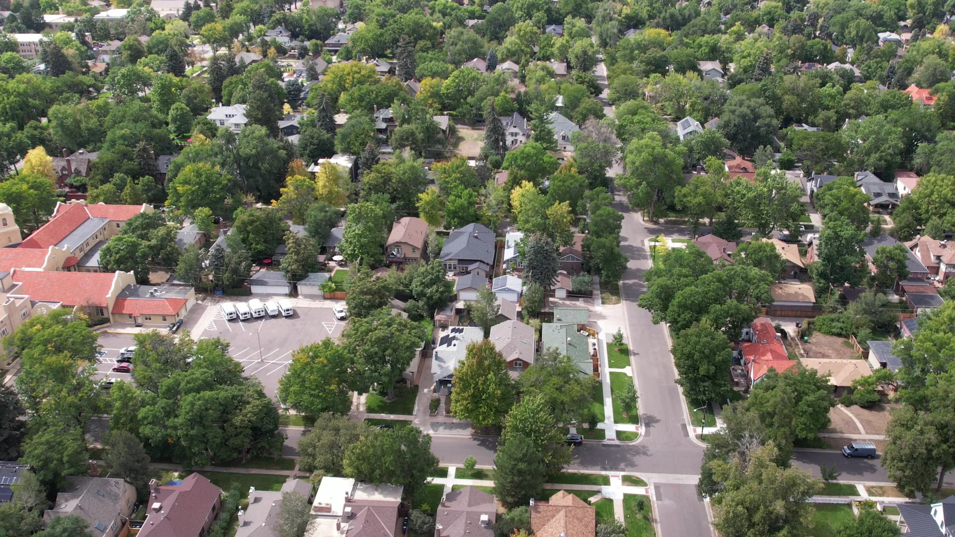
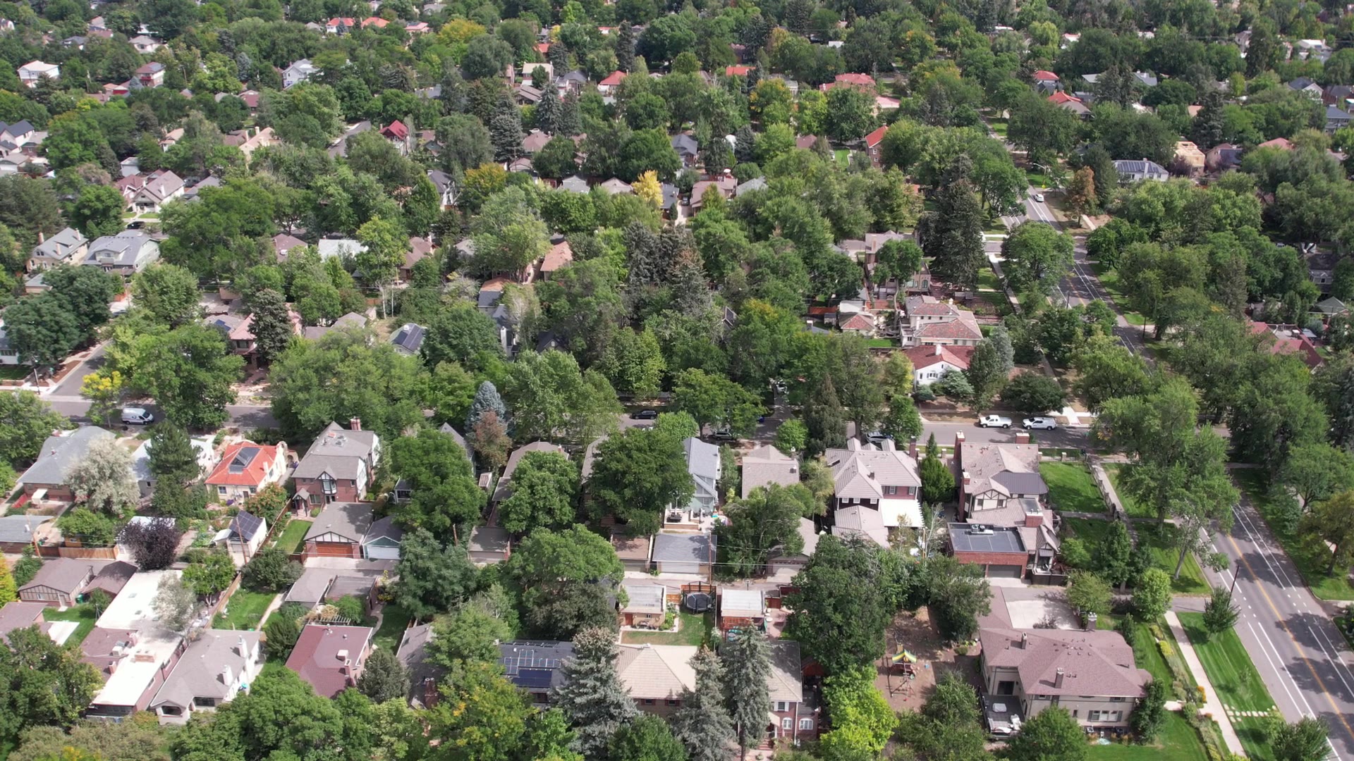
You'll find Tudors, Denver squares, brick bungalows and larger estates. Park Hill was an early streetcar suburb, among the first areas near Denver built up purely for housing, and early developers required houses to sit forty feet back from the street. In the National Register area, buildings run from about 1893 to 1954, with major construction in about 1907 to 1917 and 1920 to 1930. A later wave in the 1940s and 1950s met postwar demand, especially near the former Stapleton airport, so mid-century houses are part of the mix.
The history behind the housing
Park Hill's housing history includes race, and the record is documented. Developers here used restrictive covenants to limit how land and homes could be used, and Downington, to the west, included racial restrictions. After World War II, Black buyers, many from Five Points, began buying homes to the east, closer to Park Hill. Those seeking a home in Park Hill faced banks unwilling to lend. In blockbusting, real estate agents steered them onto streets where their arrival set off white flight, which brought the agents more sales. In 1960, Park Hill churches and residents met at Montview Presbyterian Church and founded the Park Hill Action Committee.
Parents of Denver schoolchildren sued the school district in 1969. Their case, Keyes v. School District No. 1, challenged attendance zones, optional zones and mobile classrooms in Park Hill. The U.S. Supreme Court ruled in 1973 and sent the case back to the district court, and court-enforced desegregation of Denver Public Schools followed.
How do schools work in Park Hill?
Park Hill is in Denver Public Schools. In some parts of the city, DPS uses a boundary that assigns one school. In others, it uses an enrollment zone that guarantees a seat at one of several schools. The address decides which applies, so enter each home in DPS's School Finder. The SchoolChoice hotline can answer questions about schools in a zone.
What is there to do in Park Hill?
Parks, trails and open space
City Park sits across Colorado Boulevard between East 17th and East 23rd avenues, with City Park Golf to its north.
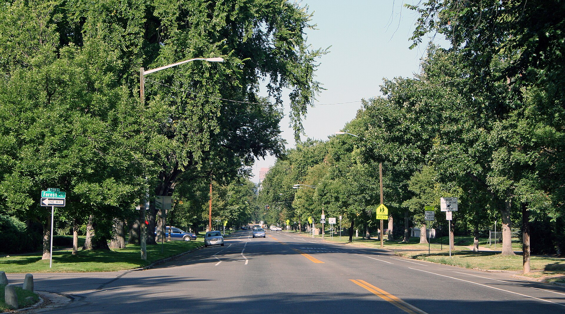
Montview Boulevard is the street to know. It was laid out in 1892 and runs about 1.5 miles from Colorado Boulevard to Monaco Street Parkway, built to serve new streetcar suburbs with tree-lined roads the city maintained. Forest Street Parkway connects East 17th Avenue to Montview, East 17th Avenue Parkway runs from Colorado Boulevard to Monaco, and Monaco Street Parkway runs south from Montview to East First Avenue.
Park Hill Park is the 155-acre former Park Hill Golf Course, bordered by Colorado Boulevard, East 35th Avenue, Dahlia Street and East 40th Avenue. The course closed in 2018, and the city acquired it in a 2025 land swap. As of October 2026, the city had selected a lead design firm, City Council was expected to take up the design contract later in the year, and formal parkland designation was planned. No construction had started. The city's timeline calls for finishing design in 2027 and starting construction in 2028.
Events
An annual Fourth of July parade runs through Park Hill, and Greater Park Hill Community sponsors its annual home tour. Check the Greater Park Hill News for current dates.
Food and shops
Some areas of South and North Park Hill have shops or a cafe within reach, and East Colfax Avenue runs along the southern edge. Farther north, Dahlia Square, between Dahlia and Elm streets and East 33rd and 35th avenues, was redeveloped starting in 2005. Businesses change, so check a current map around the block you're considering.
Three places to start
- Park Hill Branch Library — A Carnegie-funded building at 4705 Montview Blvd., designed by Merrill and Burnham Hoyt, and a Denver landmark since 1989.
- Montview Boulevard — On the National Register since 1986, and planted between 1902 and 1911.
- Park Hill Park — 155 acres of former golf course, open in its current state as of August 2026 while design moves forward.
Who are the big employers in and near Park Hill?
Park Hill was built up for housing, so the job centers sit outside its lines. Downtown is two rail stops from 40th & Colorado Station. Denver International Airport is at the far end of the same rail line, and the Tech Center is reached by I-25. Employer names change, so read this as where to look, not a ranking.
How does Park Hill compare with nearby areas?
- Park Hill vs. City Park — Colorado Boulevard is the line. The City Park neighborhood holds the park itself and sits closer to downtown. Park Hill has Montview Boulevard and the listed parkways.
- Park Hill vs. Montclair — East Colfax Avenue is the line. Park Hill's founder modeled it on Walter von Richthofen's Montclair.
- Park Hill vs. Hale — Hale is across East Colfax Avenue from South Park Hill. Monaco Street Parkway continues south across Colfax toward East First Avenue.
- Park Hill vs. Central Park — Quebec Street is the line. Central Park was built on the former Stapleton airport, which closed in 1995, so its homes are far newer than Park Hill's. Ask about HOA dues and metro district taxes there.
Buying in Park Hill: what to do first
- Get pre-approved before you tour. A 1920s Tudor and a mid-century house can be very different purchases.
- Confirm the neighborhood. Run the address against Denver's statistical neighborhood map, since South, North and Northeast Park Hill are separate.
- Pull the records. Check Denver's property search for assessment and tax data, and ask about any charges that may not appear.
- Inspect for the home's age. Schedule a general inspection, a sewer scope, a radon test and a foundation check, and run the address through Denver Water's lead search.
- Check the address. Confirm landmark status with the city, then look up FEMA's flood map and DPS's School Finder.
- Veterans: A VA loan puts the house through VA's minimum property requirements, because VA must ensure a home it finances is suitable for dwelling purposes. Those requirements can expose defects or maintenance issues, so on a house this age, get your inspections done early. If you'd like a read on current pricing for the blocks you're considering, reach out and I'll walk you through it.
In pictures
Watch the videos
Help shape what Jimmy films next
Which town should Jimmy cover next, and what do you still want to know? Tell us, and we'll email you when the guide and video are out.
Thank you — this genuinely helps. We'll let you know when it's ready.
Frequently asked questions
What's the difference between South, North and Northeast Park Hill?
They're three separate official Denver neighborhoods that make up Greater Park Hill. South Park Hill is the southern piece, North Park Hill is directly north of it, and Northeast Park Hill runs farther north. This guide covers all three.
Where does Park Hill start and stop?
Greater Park Hill is bordered by Colorado Boulevard, East Colfax Avenue, Quebec Street and East 52nd Avenue. Denver's statistical neighborhood map shows the lines between South, North and Northeast Park Hill.
Is Park Hill a historic district?
Part of it is on the National Register of Historic Places: the area bounded by Colorado Boulevard, 26th Avenue, Dahlia Street and Montview Boulevard. That listing is honorary. As of fall 2026, the list of Denver landmarks shows no historic district named for Park Hill, so check the specific address.
What's happening with the Park Hill golf course site?
It's now Park Hill Park, a 155-acre city park that's open in its current state. As of October 2026, the city had selected a lead design firm, the design contract was still headed to City Council, and construction was planned for 2028.
Is there rail service in Park Hill?
As of fall 2026, there's no RTD rail stop inside Park Hill. The closest stations on the line between Union Station and Denver Airport are 40th & Colorado, in Elyria-Swansea, and Central Park. Rail service is changing during RTD's rail project as of fall 2026, so confirm with RTD.
What school district is Park Hill in?
Park Hill is in Denver Public Schools. DPS uses boundaries in some areas and enrollment zones in others, so enter the specific address in School Finder.
What should I check before buying an older home in Park Hill?
Get a general inspection, a sewer scope, a radon test and a foundation check, and run the address through Denver Water's lead search. Then confirm landmark status, Denver's property records and FEMA's flood map.
Take this guide with you
Get the printable PDF version to read offline, share with your family or mark up on your scouting trip. Enter your name and email and it's yours.
Thanks! Your guide is ready.
Download the PDFNo spam. Jimmy may follow up personally to see if you have questions about the move.
Sources
Guide reviewed November 3, 2026, and reviewed again twice a year.
- Wikipedia: List of neighborhoods in Denver (78 official neighborhoods, 1970 statistical neighborhoods; the boundary source for this guide)
- Wikipedia: Park Hill, Denver (overall borders, forty-foot setback, golf course site borders, library architects, Greater Park Hill News, annual home tour, Dahlia Square)
- Greater Park Hill Community: home page (organization, newspaper, home tour and parade listings)
- Park Hill Parade: official site (annual Fourth of July parade)
- Denver Public Library: Park Hill Neighborhood History (Greater Park Hill makeup, Montclair model, building periods, covenants, lending, blockbusting, Park Hill Action Committee, court-enforced desegregation, Stapleton dates)
- History Colorado: Park Hill, National and State Register entry (streetcar suburb, building dates, house styles)
- History Colorado: Montview Boulevard, National and State Register entry (length, 1892 layout, planting dates, purpose)
- Wikipedia: National Register listings in northeast Denver (Park Hill 2004 listing and bounds, parkways, City Park bounds, City Park Golf)
- Wikipedia: List of Denver landmarks (no district named for Park Hill; Park Hill Library, St. Thomas Episcopal Church)
- Greater Park Hill Community: Should Park Hill Seek Local Historic Designation?, May 3, 2015 (National Register as honorary recognition, design review)
- National Park Service: National Register FAQs (listing places no restrictions on non-federal owners)
- City and County of Denver: Landmark Preservation Design Guidelines (when they apply)
- U.S. Supreme Court: Keyes v. School District No. 1, 413 U.S. 189 (1973), via Justia (parents' 1969 suit, Park Hill attendance zones, optional zones and mobile classrooms, June 21, 1973 decision, remand)
- Denver Gazette: Denver plans to protect Park Hill Park from development, Oct. 13, 2026 (design firm, contract, parkland designation, timeline, course history)
- Denver7: Neighbors keeping close eye on Denver's Park Hill Park with construction on hold, Aug. 7, 2026 (open to the public, no construction, fourth-largest park, stormwater vision, Northeast Park Hill location)
- Axios Denver: Park Hill Park nears key design phase, Jan. 28, 2026 (155 acres, open in current state, 2025 land swap, Northeast Park Hill location)
- Wikipedia: 40th & Colorado station (address, Elyria-Swansea, park-and-ride, bus connections, adjacent stations, position on the line)
- Wikipedia: A Line (RTD) (station order, no stop between 40th & Colorado and Central Park)
- RTD: Rail Project FAQs (service changes effective June 7, 2026)
- Wikipedia: Interstate 70 in Colorado (Colorado Boulevard, Quebec Street and Peña Boulevard interchanges, Mousetrap, Central 70 rebuild, express toll lanes)
- Denver Public Schools: Enrollment Zones (boundaries, zones, School Finder, hotline)
- City and County of Denver: Property Search (assessment and tax data, charges that may not appear)
- Denverite: Denver sidewalk fee FAQ, December 2024 (who pays, billing, frontage, snow removal, HOAs)
- Denver Water: Lead Reduction Program (address search, line replacement)
- Colorado Department of Public Health and Environment: Radon
- FEMA: Flood Map Service Center (flood map search by address)
- Federal Register: VA Minimum Property Requirements notice, Dec. 11, 2023 (suitable for dwelling purposes, defects and maintenance issues)
- Destination Denver Colorado: Touring the Best Denver Neighborhoods (Jan. 2025), Jimmy's own observations
- Destination Denver Colorado: Denver Neighborhoods That Deliver vs. The Hype (Oct. 2025), Jimmy's own observations
Photo credits
- Photos: Jimmy Everetts / Destination Denver Colorado.
- Montview Boulevard in Denver, a parkway listed on the National Register of Historic Places: Jeffrey Beall, CC BY-SA 3.0, via Wikimedia Commons.
- Park Hill Branch of the Denver Public Library at 4705 Montview Boulevard: Jeffrey Beall, CC BY 4.0, via Wikimedia Commons.
Thinking about moving here?
Ask Jimmy anything about the area, the neighborhoods or the move itself. No pressure, just straight answers from a local.


