


LoDo
The short answer
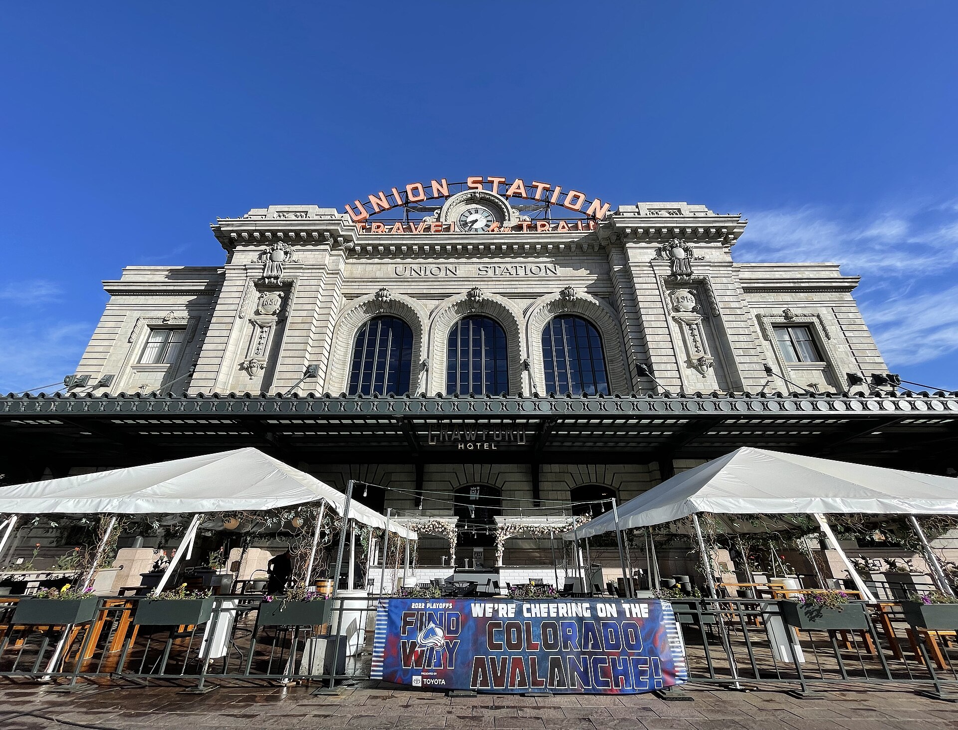
LoDo, short for Lower Downtown, is the original settlement of Denver, at the northwest end of downtown near the confluence of Cherry Creek and the South Platte River. It isn't an official neighborhood: the city's statistical neighborhood here is Union Station, and the Lower Downtown Historic District is a separate, smaller city designation. Homes are condos, lofts and apartments, many in converted warehouses. Denver Union Station connects RTD light rail, commuter rail to the airport, Amtrak and regional buses, and I-25 is just across the river.
Watch: Jimmy's video on this area
What is living in LoDo like?
LoDo is more of a going-out area, with restaurants, bars and nightclubs. There are condos and apartments, you're close to Coors Field, and older industrial buildings have been turned into lofts and apartments.
Start with the names, because three things get blurred here. LoDo is the everyday name. Union Station is the statistical neighborhood the city uses for data and records, and it's also a train station. The Lower Downtown Historic District is a city designation with its own design review. If you're still choosing a part of the metro, start with the Denver relocation guide.
What draws people here
- Denver Union Station. Light rail, commuter rail, Amtrak and regional buses meet at one hub inside the neighborhood.
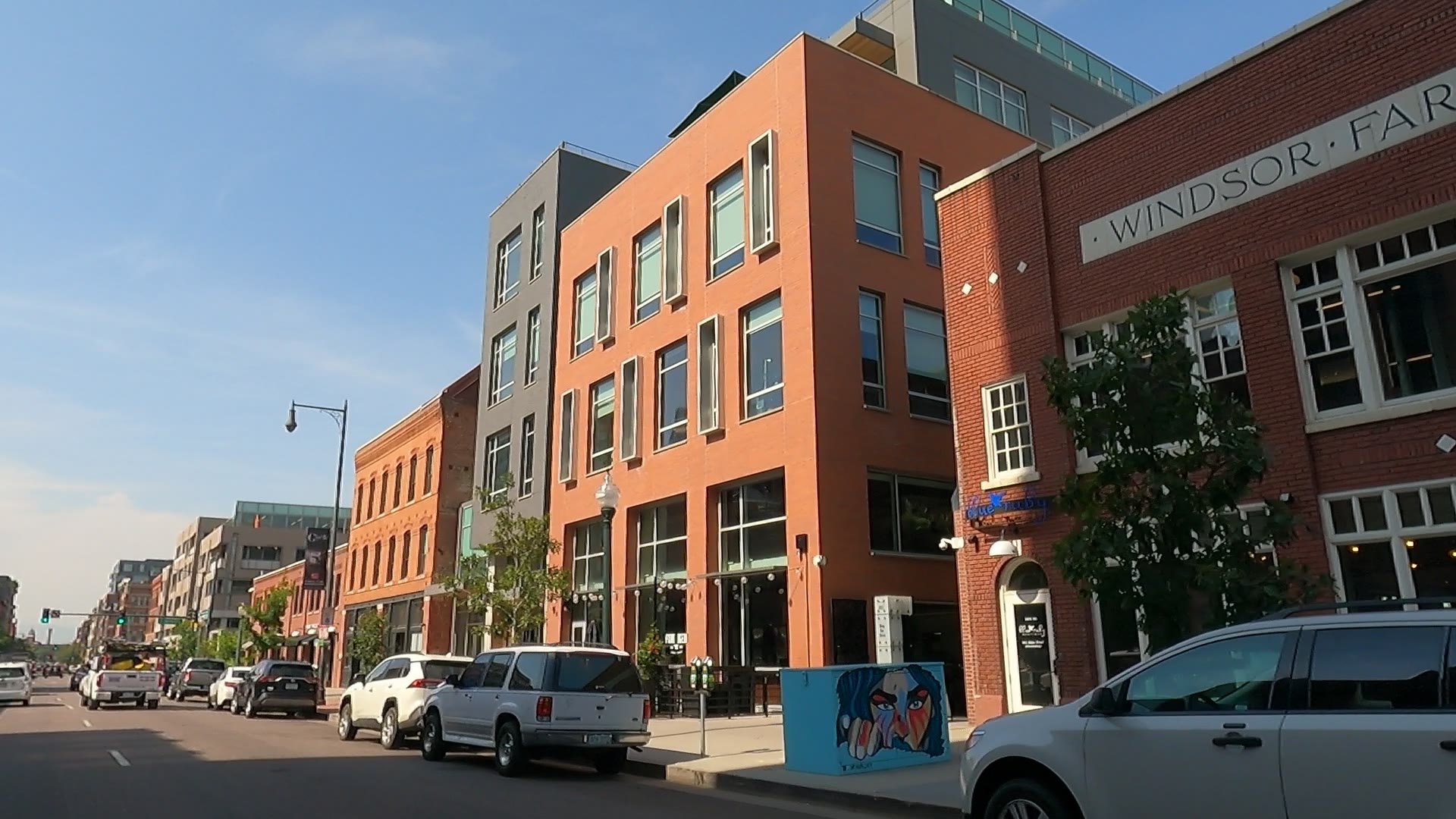
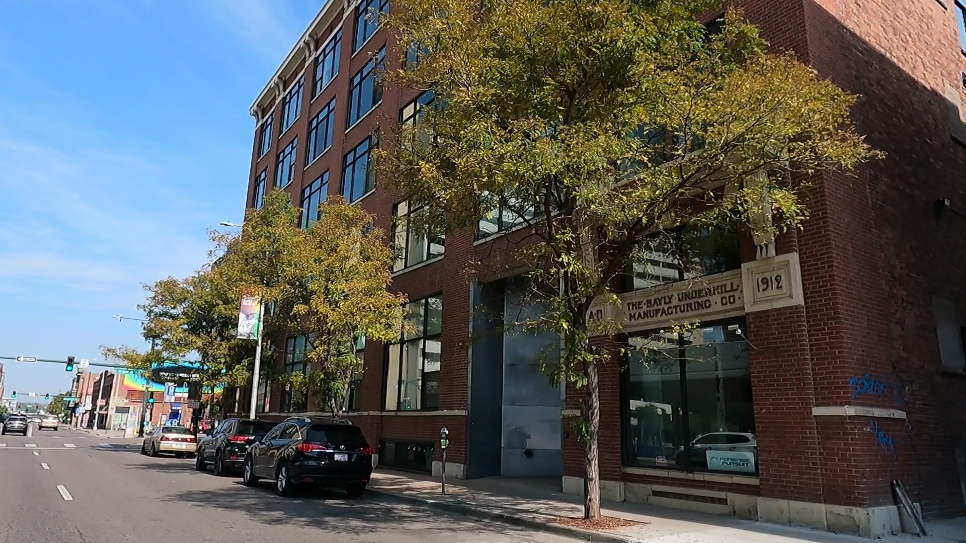
- Warehouse buildings. Red-brick warehouses from Denver's railroad years were reused as lofts and apartments, and many of the district's old buildings have shops on the ground floor.
- Restaurants and bars. LoDo and 16th Street together hold hundreds of bars, restaurants and cafes.
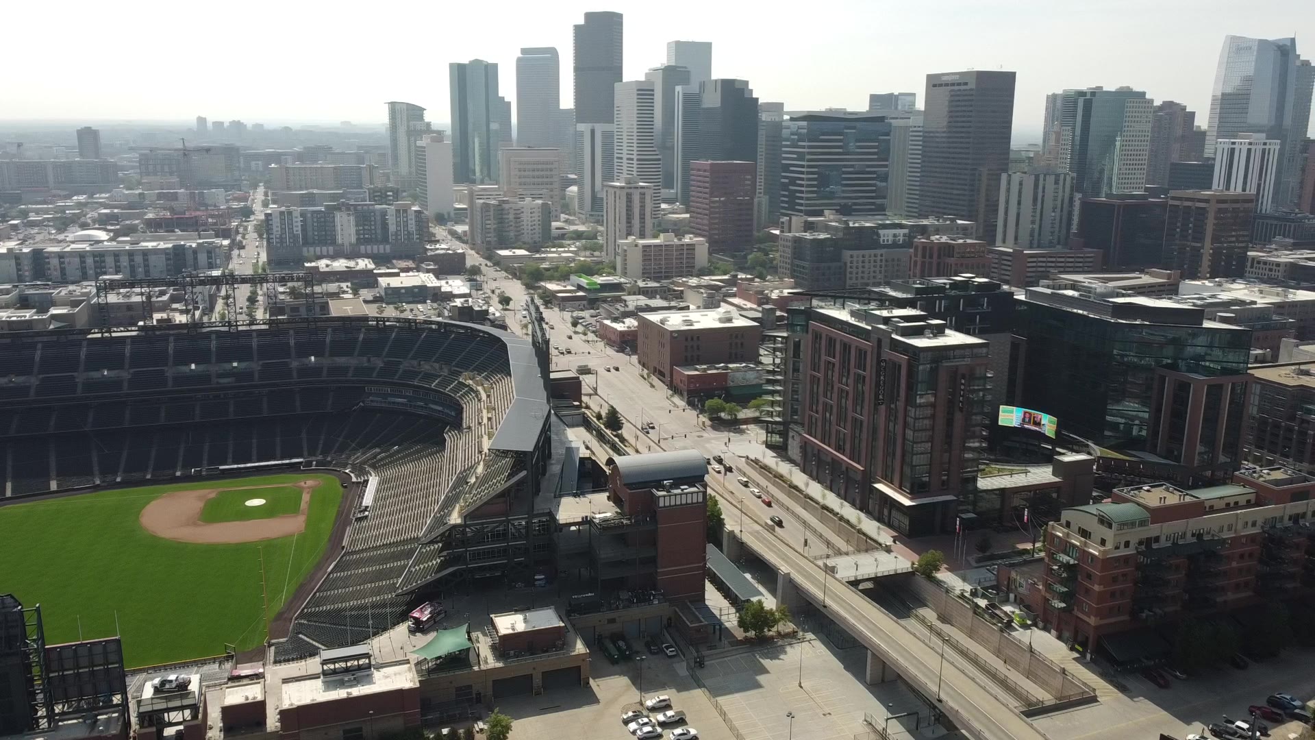
- Coors Field. The Rockies have played here since 1995, at the edge of the historic district.
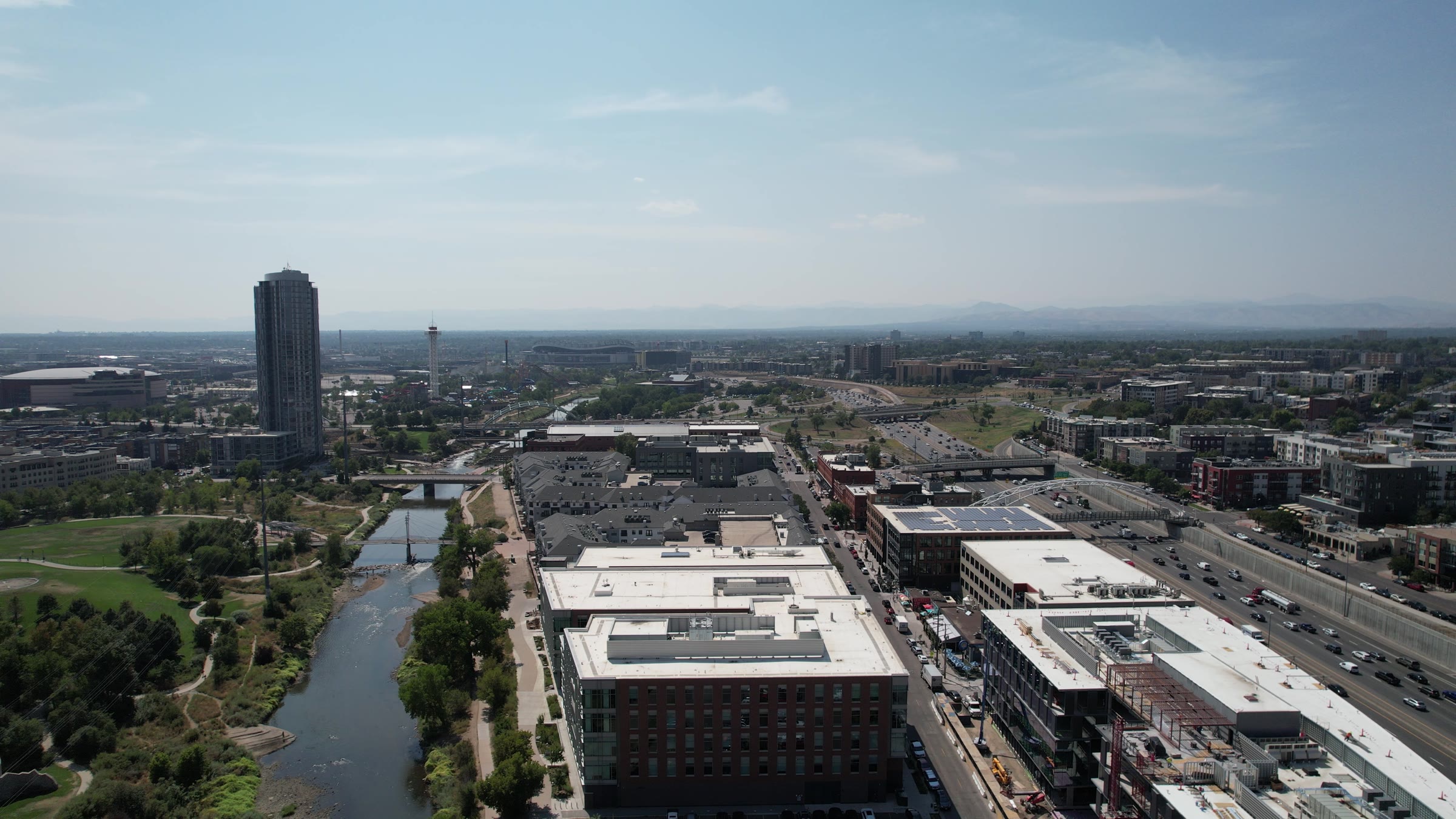
- The river. Commons Park covers about 20 acres along the South Platte River, and the South Platte River Trail runs past it.
What gives people pause
- Dues. Condos and lofts come with association dues, so compare the full monthly cost, not just the mortgage.
- Parking. A space may not come with the unit, so it can be a separate cost.
- Busy hours. Bars, restaurants and nightclubs sit close to homes, and game days bring baseball crowds to the edge of the district. Visit the block on a game day and late on a weekend night before you decide.
- Building rules. Exterior work in the historic district goes through design review, and lenders review the condo project as well as the buyer.
- Flood maps. The South Platte River and Cherry Creek both run along this area, so check FEMA's map.
Where is LoDo, and how do you get around?
LoDo sits at the northwest end of downtown. Highland lies to the west across the river and I-25, Five Points lies to the north, and the Central Business District lies to the southeast. As of fall 2026, RTD's downtown rail project has changed some light rail service, so confirm your trip with RTD before you count on it.
- Into downtown: You're already there. Downtown is made up mostly of the Union Station and Central Business District neighborhoods. RTD's 16th Street FreeRide runs along 16th Street, and the MetroRide connects Union Station and Civic Center at weekday peak times.
- Into the Tech Center: I-25 is the drive, with exits at 20th Street and Park Avenue near Coors Field. By rail, light rail runs from Union Station to Belleview Station, a transfer point during the rail project.
- Transit: Denver Union Station is the region's hub. It ties together RTD light rail and commuter rail, Amtrak, regional buses, taxis and shuttles, with a 22-bay underground bus facility. Bustang and Greyhound also use that facility.
- The airport: Commuter rail runs from Union Station to Denver International Airport. By car, take I-25 north to I-70, then I-70 east to Peña Boulevard.
- The mountains: Take I-25 north to the Mousetrap interchange, then I-70 west through the Rockies. Amtrak's Winter Park Express uses Union Station in winter, so check its current schedule.
Where does LoDo start and stop?
The official lines come from Denver's statistical neighborhoods. Denver has 78 official neighborhoods, which grew out of the census-tract groups city planners drew in 1970, and the city uses the map for data, research and records. There's no formal process for naming a neighborhood, so "LoDo" isn't on that map.
Union Station, the statistical neighborhood
This is the official boundary for this guide. Its northwest line is the South Platte River, and its northeast line is 20th Street. Published descriptions differ on the other two sides: Lawrence or Larimer Street on the southeast, and 14th Street or Cherry Creek on the southwest, so check an address on Denver's map. It takes in much of the historic district, plus the former rail yard behind the station.
The Lower Downtown Historic District
This is a separate, smaller area. Denver City Council created it by zoning ordinance in March 1988 to protect 127 contributing historic structures. Its rough borders are Cherry Creek and Speer Boulevard, Wewatta Street, 20th Street, and the alley between Market and Larimer streets. Much of the district sits inside Union Station, but the lines differ.
Union Station, the building
Denver Union Station stands at 1701 Wynkoop St. It gives the neighborhood its name, but the historic district's line skips it. The station has its own National Register listing, dating to 1974.
Central Platte Valley and Riverfront Park
Behind the station, the Central Platte Valley was once a railyard and industrial zone. The former rail yard there is part of the Union Station neighborhood. The Central Platte Valley and the Riverfront Park area sit outside the historic district, though many people count them as part of LoDo.
How the name gets used
The LoDo District, a nonprofit and Registered Neighborhood Organization, treats the historic district as its core. It draws its neighborhood from Larimer Street on the east to I-25 on the west, with 20th Street on the north and the Auraria and River Mile areas on the south. So "LoDo" can mean more than the historic district.
Nearby areas often confused with it
Larimer Square is the 1400 block of Larimer Street, on the far side of the alley that marks the historic district's southeast line, and it has its own historic district, the city's first. Coors Field stands at the edge of the Lower Downtown district. The Ballpark area, which includes the stadium and several blocks east, is part of the Five Points statistical neighborhood. If the name matters to you, go by the address on Denver's map, not the name on a sign.
What does it cost to own a home in LoDo?
Prices and tax amounts change, so this guide points you to where to check them. With a condo or loft, much of the cost runs through the building, not just the unit.
- HOA dues: Find out what the dues cover and what they've been in recent years.
- Reserves: Reserves are an association's savings for large repairs. Ask for the budget, financial statements and latest reserve study. If the savings fall short, owners can be asked to pay more.
- Condo project approval: A lender reviews the project as well as you, looking at things such as its financial stability, litigation and insurance. The steps depend on the project and the loan, so have your lender look at the building early.
- Parking: A space may be included, sold separately or rented, so price it as its own line. Confirm what the contract gives you and what the association's rules say.
- Lower Downtown design review: In the historic district, the Lower Downtown Design Review Commission reviews new construction, alterations, signs and demolition. Approved projects get a Certificate of Appropriateness, which goes in with any later building or zoning permit application. Talk to your association first if you're planning exterior work.
- Property tax: Denver's property search shows assessment and tax data by address, parcel ID or schedule number. Some charges, such as maintenance district and business improvement fees, may not show up there at certain times of year, so ask about them.
- Sidewalk fee: Denver's fee appears on the municipal stormwater bill, split into two payments a year. When an HOA handles that bill, the HOA handles the fee, so ask whether your dues cover it.
- Flood insurance: FEMA's Flood Map Service Center lets you search the official flood map by address. Run any home near the river or the creek, and ask your insurance agent what the result means.
What kinds of homes are in LoDo?
Expect lofts, condos and apartments. Inside the historic district, zoning limits building height, encourages mixed use and sets design guidelines.
The buildings explain the housing. Denver was founded at the confluence in November 1858, and an 1863 fire pushed the district from wood to brick and stone. The railroad arrived in 1870, and large wholesale warehouses grew up around the rail yards from the mid-1870s. Warehouse Row along Wynkoop Street is the example to walk. After World War II the area went into a slow decline, and urban renewal took down part of it in the 1960s and 1970s. The Edbrooke Lofts conversion came at the start of LoDo's revival in 1990, two years after the historic district was created.
The Central Platte Valley has a different story. It was railyard and industrial land, so check each building's age there rather than assuming.
How do schools work in LoDo?
Schools here fall under Denver Public Schools. The district assigns by single-school boundary in some areas and by enrollment zone in others. A zone guarantees a seat at one of several schools rather than one named school. Because this depends on the address, enter each home you're considering into DPS's School Finder. The SchoolChoice hotline can explain the schools in a zone, and DPS posts zone guides for elementary, middle and high school.
What is there to do in LoDo?
Parks, trails and open space
Commons Park covers about 20 acres just north of the confluence of Cherry Creek and the South Platte River, with a promenade along Little Raven Street, lawns, recreational fields and riverbank wetlands. The land was a gathering place for Native American tribes. It later became railroad property, and the city acquired part of it for the park.
Events
The Rockies have played at Coors Field, 2001 Blake St., since 1995, and home games shape the calendar here. Ball Arena is also downtown. Larimer Square is known for its seasonal lighting displays. The LoDo District holds networking and social events and helps run Cherry Creek Sweeps, a seasonal cleanup. Check each group's calendar for dates.
Food and shops
Union Station's ground level has independent shops and restaurants. Larimer Square is a mixed-use block of restaurants, shops, offices and entertainment venues. Wynkoop Brewing Company, a brewpub founded in 1988, and the Oxford Hotel, built in 1891 and home of the art deco Cruise Room bar, are two older names in the district.
Three places to start
- Denver Union Station — The central part of the building dates to 1914. The Great Hall at 1701 Wynkoop St. doubles as the Crawford Hotel's lobby and the train waiting room.
- Commons Park — About 20 acres along the South Platte River. Look for the 40-foot black marble compass.
- Larimer Square — The 1400 block of Larimer Street, where late-19th-century buildings of mostly two to four stories still form one streetscape. Dana Hudkins Crawford began acquiring and rehabilitating them in the 1960s.
Who are the big employers in and near LoDo?
LoDo sits inside downtown Denver. Downtown is the city's main financial, commercial, business and entertainment district, and most of it falls in the Union Station and Central Business District neighborhoods. The Federal District, around Champa, Stout, 19th and 20th streets, holds a federal courthouse, an appeals court and a customs house. The Auraria Campus lies to the south, and Coors Field and Ball Arena both sit downtown. Employer rosters change, so treat these as the places to look rather than a ranked list.
How does LoDo compare with nearby areas?
- LoDo vs. the Central Business District — The Union Station and Central Business District neighborhoods make up most of downtown. Lower Downtown's height limits and design review apply inside the historic district.
- LoDo vs. Ballpark and Five Points — 20th Street is the line. The Ballpark area, including Coors Field, is part of the Five Points statistical neighborhood.
- LoDo vs. LoHi — LoHi is the eastern part of Highland, across the South Platte River and I-25. A pedestrian route runs from the end of 16th Street over the Denver Millennium Bridge, the Platte River Bridge and the Highland Bridge.
- LoDo vs. Auraria — Cherry Creek and Speer Boulevard mark the historic district's southwest side. Auraria, which merged with Denver City in 1860, lies beyond them, and the name now also means the Auraria Campus.
Buying in LoDo: what to do first
- Get pre-approved before you tour. Once you have a building in mind, your lender will need to look at the project as well as your finances.
- Confirm which LoDo you mean. Check the address against Denver's map, and find out whether it's in the historic district or only near it.
- Get the association documents. Ask for the budget, financial statements, reserve study and rules, and read them before you're committed.
- Pin down parking. Find out whether a space comes with the unit, how it's held and what it costs.
- Check the address. Use Denver's property search, FEMA's flood map and DPS's School Finder, and ask about design review if you plan any exterior work.
- Veterans: If you're using a VA loan, check the condo project first. VA keeps a list of approved condos. If the condo isn't on the list, the project must be submitted to VA for review, so ask about this early. If you'd like a read on current pricing for the blocks you're considering, reach out and I'll walk you through it.
In pictures
Watch the videos
Help shape what Jimmy films next
Which town should Jimmy cover next, and what do you still want to know? Tell us, and we'll email you when the guide and video are out.
Thank you — this genuinely helps. We'll let you know when it's ready.
Frequently asked questions
Is LoDo an official Denver neighborhood?
No. The city's statistical neighborhood here is Union Station. Lower Downtown is a historic district, and LoDo is the everyday name for it and the blocks around it.
What's the difference between LoDo, Union Station and the Lower Downtown Historic District?
Union Station is the city's statistical neighborhood, and it's also the train station at 1701 Wynkoop St. The Lower Downtown Historic District is a smaller city designation created in 1988. LoDo is the everyday name, and people use it for the district and the areas around it.
Is Larimer Square in LoDo?
In everyday use, yes. Officially, no. Larimer Square is the 1400 block of Larimer Street, outside the Lower Downtown Historic District, and it has its own historic district.
Is Coors Field in LoDo?
It stands at the edge of the Lower Downtown Historic District, at 2001 Blake St., and it opened on April 26, 1995. The Ballpark area around it is part of the Five Points statistical neighborhood.
How do you get from LoDo to the airport?
Commuter rail runs from Denver Union Station to Denver International Airport. Service is changing during RTD's rail project as of fall 2026, so confirm with RTD. By car, take I-25 north to I-70, then I-70 east to Peña Boulevard.
What school district is LoDo in?
LoDo is in Denver Public Schools. DPS uses boundaries in some areas and enrollment zones in others, so enter the specific address in its School Finder.
What should I check before buying a condo in LoDo?
Get the association's budget, financial statements and reserve study, and have your lender review the project early. Then confirm the parking, check whether the address is in the historic district, and run it through Denver's property search and FEMA's flood map.
Take this guide with you
Get the printable PDF version to read offline, share with your family or mark up on your scouting trip. Enter your name and email and it's yours.
Thanks! Your guide is ready.
Download the PDFNo spam. Jimmy may follow up personally to see if you have questions about the move.
Sources
Guide reviewed November 3, 2026, and reviewed again twice a year.
- Denver Statistical Neighborhoods, City and County of Denver data on the Colorado Information Marketplace, updated Feb. 19, 2026 (the official boundary dataset and the boundary source for this guide)
- Wikipedia: Union Station, Denver (published street lines for the statistical neighborhood, overlap with the historic district, pedestrian route over three bridges)
- Denver Architecture Foundation: Union Station neighborhood (published street lines for the city designation, former rail yard, Central Platte Valley)
- Denver Public Library: Lower Downtown Denver (street lines for the area, Union Station neighborhood)
- Wikipedia: List of neighborhoods in Denver (78 official neighborhoods, 1970 statistical neighborhoods, original settlement, Ballpark, LoHi)
- FOX31 via Yahoo: Why RiNo and LoDo aren't listed in Denver's neighborhoods (how the map works, LoDo's status)
- Wikipedia: LoDo, Denver (historic district borders, 1988 ordinance, zoning, Larimer Square outside the district, Wynkoop Brewing, Oxford Hotel)
- Denver Public Library: LoDo, Denver's Lower Downtown Success Story (founding, 1863 fire, railroad, warehouses, decline, 1988 designation, Edbrooke Lofts, Coors Field, Auraria merger)
- American Planning Association: Lower Downtown, Denver, Colorado, undated (confluence, warehouse reuse, ground-floor retail)
- City and County of Denver: Lower Downtown Design Review Commission (what it reviews)
- City and County of Denver: Landmark Preservation Design Review Process (Certificate of Appropriateness)
- City and County of Denver: Landmark Preservation Design Guidelines (Lower Downtown's own guidelines and review process)
- City and County of Denver: Urban Design, Design Review, Design Standards and Guidelines (Design Guidelines for the Lower Downtown Historic District)
- AIA Colorado: Lower Downtown Design Review Commission job description (project types and guidelines the commission applies)
- Westword: Denver's Union Station neighborhood needs a nickname, about 2019 (historic district's edge at the station, Central Platte Valley history)
- LoDo District, Inc.: About (organization, neighborhood boundaries, events, Cherry Creek Sweeps)
- Wikipedia: Larimer Square (block, first historic district, National Register, Dana Hudkins Crawford, buildings, lighting displays)
- Wikipedia: Coors Field (address, April 26, 1995 opening, I-25 exits)
- The Cultural Landscape Foundation: Commons Park (size, location, features, site history, river trail)
- Wikipedia: Denver Union Station (address, building dates, National Register, Great Hall, Crawford Hotel, shops, bus facility users, Amtrak)
- RTD: Denver Union Station facts and figures (hub, 22-bay bus facility, commuter rail to the airport, MetroRide)
- RTD: Rail Project FAQs (service effective June 7, 2026, FreeRide, MetroRide, Belleview transfers)
- Wikipedia: Downtown Denver (what downtown is, its neighborhoods and neighbors, bars and restaurants, Federal District, Ball Arena)
- Wikipedia: Interstate 70 in Colorado (Mousetrap, Peña Boulevard exit, route through the Rockies)
- Denver Public Schools: Enrollment Zones (zones, School Finder, hotline, guides)
- City and County of Denver: Property Search (assessment and tax data, fees that may not appear)
- Denverite: Denver sidewalk fee FAQ (billing, HOAs)
- FEMA Flood Map Service Center (flood map search by address)
- Fannie Mae Selling Guide: General Information on Project Standards (what lenders review on condo projects, budgets and reserve studies)
- U.S. Department of Veterans Affairs: VA Home Loan Guaranty Buyer's Guide, April 2022 (list of approved condos, project review)
- Destination Denver Colorado: Touring the Best Denver Neighborhoods (Jan. 2025), Jimmy's own observations
- Destination Denver Colorado: Denver vs. Fort Collins (2025), Jimmy's own observations
Photo credits
- Photos: Jimmy Everetts / Destination Denver Colorado.
- Denver Union Station: Sarah Stierch (Missvain), CC BY 4.0, via Wikimedia Commons.
Thinking about moving here?
Ask Jimmy anything about the area, the neighborhoods or the move itself. No pressure, just straight answers from a local.


