


Cherry Creek
The short answer
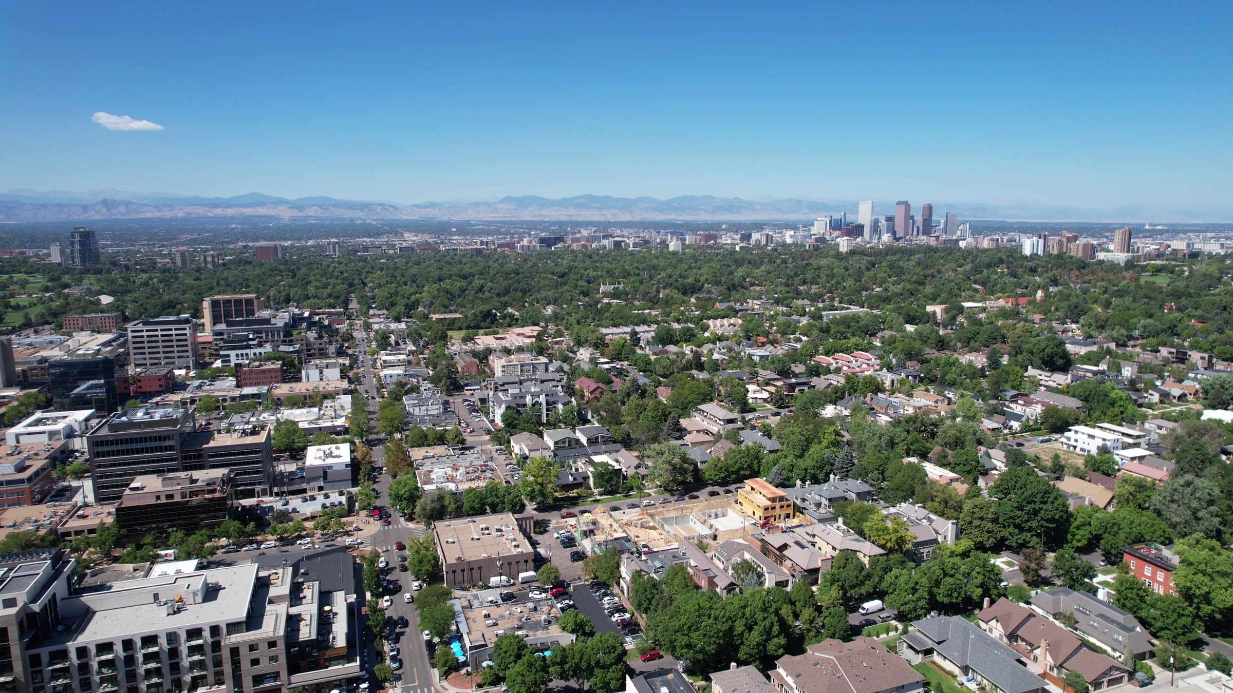
Cherry Creek is a Denver neighborhood southeast of downtown, running from the creek north to East Sixth Avenue between University and Colorado boulevards. It holds the Cherry Creek Shopping Center and the 16 blocks of Cherry Creek North, with condos, townhomes and single-family homes around them. East First Avenue connects it to downtown as the continuation of Speer Boulevard, the Cherry Creek Trail runs there too, and RTD serves the area by bus rather than rail. It's in Denver Public Schools, not the Cherry Creek School District.
Watch: Jimmy's video on this area
What is living in Cherry Creek like?
To me, Cherry Creek is one of the most walkable neighborhoods in all of Denver. It's the closest Denver gets to that big city vibe. You've got the shopping center, boutique shops, jewelry, restaurants, coffee shops and a lot of offices, and it's a hub for business lunches and coffee meetings. Parking can be a pain. Most places close around 9:30 or 10, so it winds down early compared with the Highlands or RiNo.
Start by sorting out the name, because four different things carry it. The creek runs along the south side of the neighborhood. Cherry Creek State Park is a state park around a reservoir at 4201 S. Parker Road in Aurora. The Cherry Creek School District is in western Arapahoe County. This guide covers the Denver neighborhood, which is in Denver Public Schools. If you're still choosing a part of the metro, start with the Denver relocation guide.
What draws people here
- Errands on foot. Cherry Creek North has 16 blocks of shops, galleries and restaurants, and the shopping center sits just across First Avenue.
- The trail. The paved, 40-mile Cherry Creek Trail starts at Confluence Park downtown.
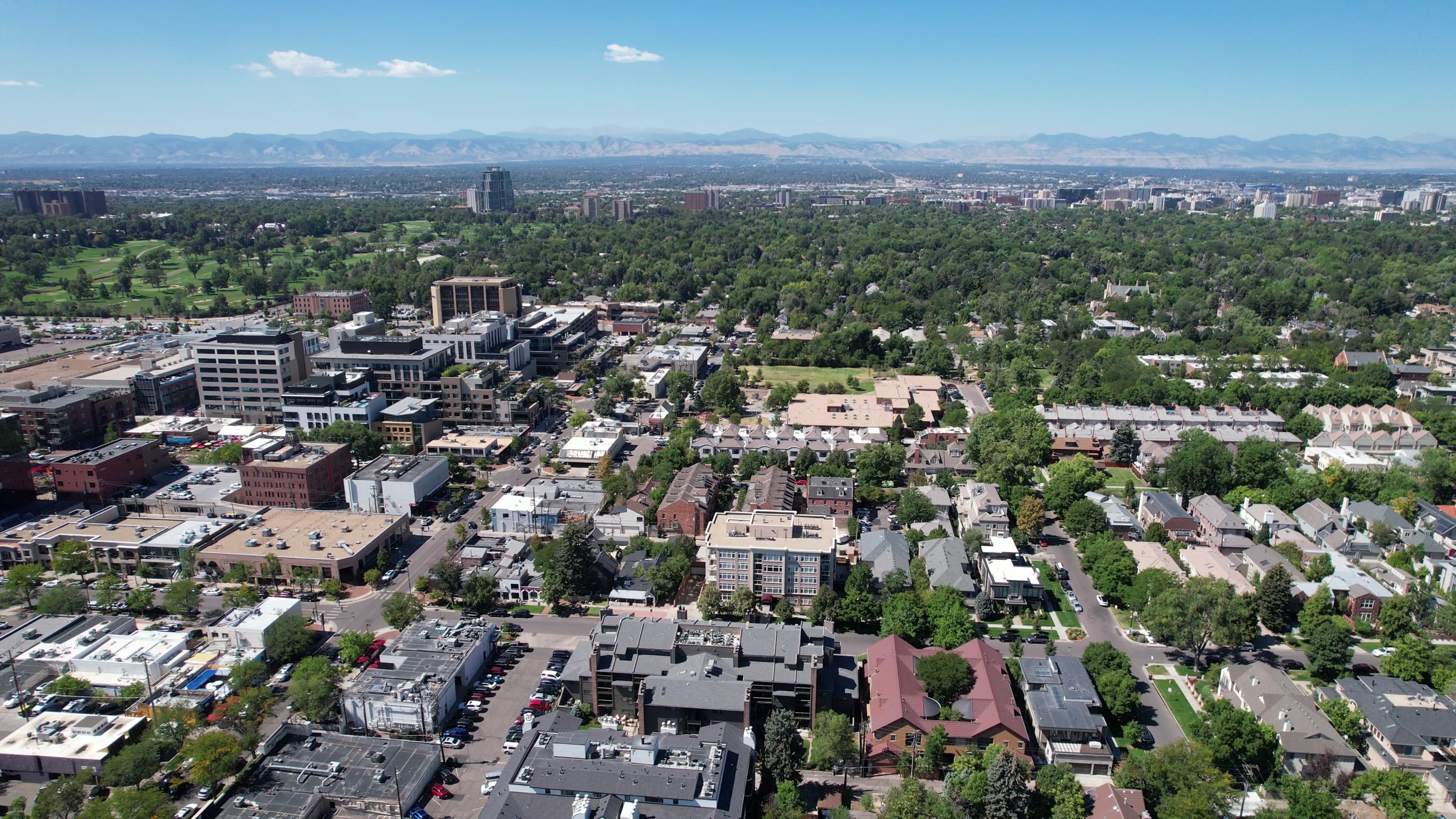
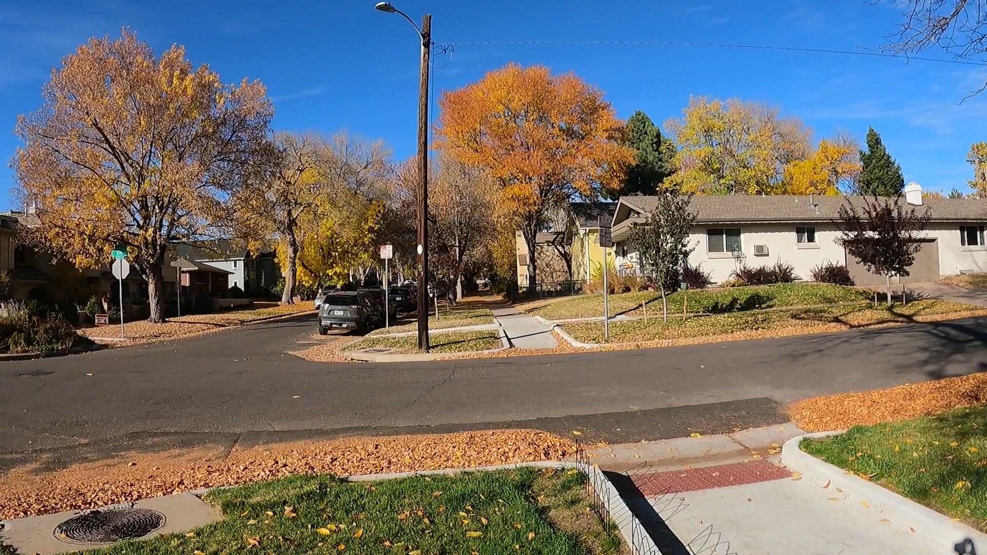
- A range of housing types. Condos, townhomes and single-family homes on tree-lined streets.
- A district that keeps up the blocks. Cherry Creek North's business improvement district handles day-to-day maintenance and operations, plus streetscape design, lighting and seasonal touches.
What gives people pause
- Parking. Street parking in Cherry Creek North is metered and time-limited. If a home doesn't include a space, work that out before you buy.
- Construction. Cherry Creek North has had a run of large-scale infill projects since 2020, with more in review as of April 2026. Cherry Creek West, a 13-acre redevelopment at University Boulevard and East First Avenue, started demolition in March 2026, and its first phase is expected to run through summer 2029.
- Taller neighbors. Zoning adopted in 2014 set a 12-story maximum in the business core, with heights stepping down toward the homes around it. What's next door can change after you buy.
- No rail. RTD service here is by bus.
- Flood maps. The creek forms the south edge of the neighborhood, so check FEMA's map for any address close to it.
Where is Cherry Creek, and how do you get around?
Cherry Creek sits near the geographic center of Denver, southeast of downtown. Four main routes serve it: Speer Boulevard and East First Avenue, University Boulevard, Colorado Boulevard and East Seventh Avenue Parkway. As of fall 2026, RTD's Downtown Rail Reconstruction Project is changing rail service, so confirm any trip with RTD before you count on it.
- Into downtown: First Avenue, which Speer turns into, runs right through the neighborhood. The Cherry Creek Trail connects to downtown by bike. As of September 2026, RTD's Route 83L, the Cherry Creek/Parker Road Limited, runs to Union Station.
- Into the Tech Center: Take University or Colorado Boulevard to I-25, then head south. RTD's Route 40 runs on Colorado Boulevard to Southmoor Station, a light rail stop on the way to the Tech Center.
- Transit: RTD service here is by bus, with no rail station inside the neighborhood. Route 24 runs on University Boulevard and Route 40 on Colorado Boulevard. Other lines cross the area, so check RTD's current map.
- The airport: By transit, take the train from Denver International Airport to 40th & Colorado Station, then Route 40 south to Colorado Boulevard and Third Avenue. By car, take Colorado Boulevard north to I-70, then I-70 east to Peña Boulevard.
- The mountains: Take Colorado Boulevard north to I-70, the route through the Rocky Mountains, and go west.
Where does Cherry Creek start and stop?
The official lines come from Denver's statistical neighborhoods. That map dates to the 1970s, is based on census tracts, and serves city agencies as a reference for data, research and records. Denver has no formal process for naming neighborhoods, so a name on a sign doesn't change the map.
The Cherry Creek statistical neighborhood runs from the creek on the south to East Sixth Avenue on the north, and from University Boulevard on the west to Colorado Boulevard on the east. You'll also see the south edge drawn at Alameda Avenue.
Cherry Creek North
This is the retail district. Its business improvement district covers 16 blocks from First Avenue to Third Avenue, between University Boulevard and Steele Street. It was established in 1989 as the first business improvement district in Colorado. North of Third Avenue, the neighborhood continues to Sixth, and much of the area outside the commercial core is residential.
Cherry Creek Shopping Center
The enclosed mall stands south of First Avenue at 3000 E. 1st Ave. Developer Temple Buell bought gravel-pit land here in 1925, and after the 1933 flood the city used the creek-side land for garbage dumps. Buell's original center was completed in 1955, and its redevelopment into today's mall was completed in 1990.
Cherry Creek East
The Cherry Creek East Association gives its area as First Avenue to Alameda Avenue and Steele Street to Colorado Boulevard, next to both the shopping center and Cherry Creek North. It's an association's area, not a separate statistical neighborhood.
Nearby areas often confused with it
Four official neighborhoods share a border with Cherry Creek. University Boulevard separates it from Country Club, Colorado Boulevard from Hilltop, the creek from Belcaro and Sixth Avenue from Congress Park.
What does it cost to own a home in Cherry Creek?
Prices and tax amounts change, so this guide points you to where to check them. These are the costs that apply here.
- Property tax: Denver's property search shows assessment and tax data by address, parcel ID or schedule number. The city notes that maintenance district fees, service lien fees and business improvement fees may or may not show there, so ask about them for the specific property.
- Business improvement district: Cherry Creek North's district is primarily funded by private commercial taxpayers, so ask whether any district charge applies to a property inside its 16 blocks.
- HOA or condo dues: If a home has an association, find out what the dues cover, including parking, and who pays the stormwater bill. When an HOA handles that bill, the HOA pays the sidewalk fee.
- Sidewalk fee: Denver's sidewalk fee began in 2025 and applies to all property types. As of its 2025 rollout, it appears on the municipal stormwater bill in two payments a year, and properties with a long street frontage pay an added amount. Owners still have to clear snow, ice and debris.
- Parking: If a home doesn't include a space, find out what a garage space would cost.
- Landmark status: As of fall 2026, the list of Denver landmarks shows no historic district named for Cherry Creek, but individual landmarks exist here, including the Old Town of Harman Town Hall at 400 St. Paul St. Check the specific address before you plan exterior work.
- Older-home systems: Denver Water's address lookup shows a property's risk of lead in drinking water, and it's replacing lead service lines with copper. On an older house, get a sewer scope and test for radon too.
- Flood insurance: FEMA's Flood Map Service Center is the official public source for flood hazard information, and you can search it by address. FEMA updates its maps regularly, so run the search yourself and ask your insurance agent what it means for that home.
What kinds of homes are in Cherry Creek?
Expect condos, townhomes and single-family homes on tree-lined streets. Newer residences are mixed in with some of Denver's older homes.
The older story starts with the town of Harman, incorporated in 1886 and annexed by Denver by 1895. Its 1891 town hall still stands at 400 St. Paul St., and a developer converted it to a residence after buying it in 2005.
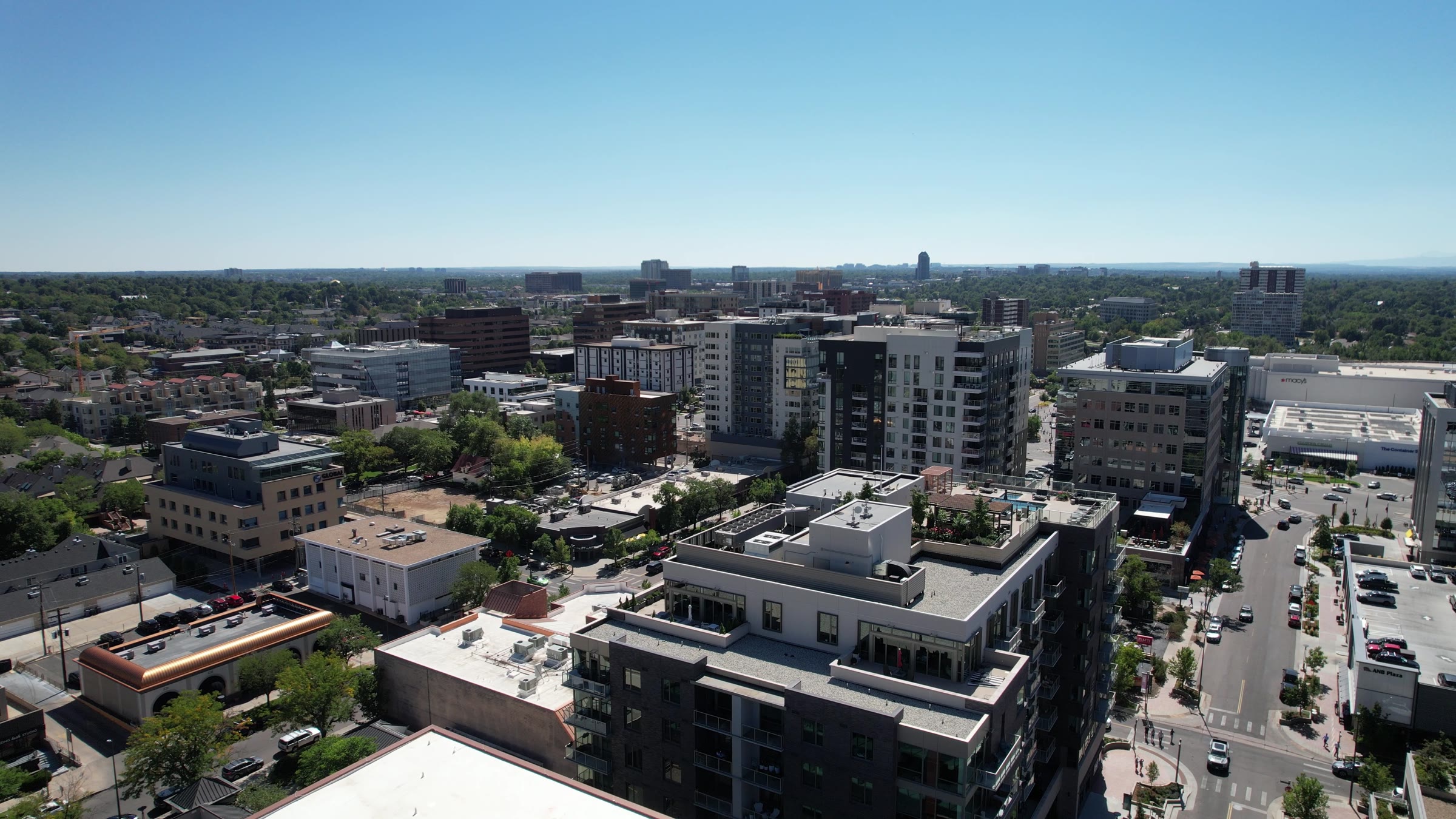
The newer story is zoning. For 25 years the code here capped buildings at 55 feet. After the 2012 Cherry Creek Area Plan, the City Council adopted new zoning for Cherry Creek North in 2014. It allowed up to 12 stories in the business core, stepped heights down toward the surrounding homes and reduced parking requirements. A hotel, condos, apartments and offices were under way as the code changed, and infill has continued since. Check current zoning with the city for any block you're considering.
How do schools work in Cherry Creek?
Cherry Creek is in the City and County of Denver, so it's in Denver Public Schools, not the Cherry Creek School District. The two names are often confused. The Cherry Creek School District is in western Arapahoe County and takes in parts of Aurora, Centennial, Greenwood Village and Englewood, plus Foxfield, Glendale and most of Cherry Hills Village.
DPS uses single-school boundaries in some areas and enrollment zones in others. In a zone, living there guarantees a seat at one of several schools, not one specific school. What applies depends on the address, so enter each home you're considering into DPS's School Finder. Bromwell Elementary, a DPS school at 2500 E. 4th Ave., is inside the neighborhood's lines, but a school's location doesn't tell you the assignment for a given address.
What is there to do in Cherry Creek?
Parks, trails and open space
The paved Cherry Creek Trail starts at Confluence Park downtown and runs 40 miles, following the creek past the neighborhood's south side. The Army Corps of Engineers has run an annual sediment flush at Cherry Creek Dam in Aurora, and the higher water can close portions of the trail in and around downtown for a short time.
In neighboring Congress Park, the park of the same name has tennis courts, athletic fields and one of Denver's public outdoor swimming pools.
Events
The Cherry Creek Arts Festival is held in July on and around Second Avenue in Cherry Creek North, and admission is free. The business improvement district also produces events, including holiday events.
Food and shops
Cherry Creek North mixes locally owned businesses with national brands across its shops, galleries and restaurants, and it has several hotels. The shopping center adds department stores and restaurants.
Three places to start
- Cherry Creek Trail — Follow the creek from the neighborhood's south edge toward Confluence Park downtown.
- Fillmore Plaza — An event space in Cherry Creek North. RTD's trip planner takes "1st Ave & Fillmore Plaza" as a destination.
- Old Town of Harman Town Hall — Built in 1891 at 400 St. Paul St. and designed by Franklin E. Kidder. It's a Denver landmark and has been converted to a residence, so see it from the sidewalk.
Who are the big employers in and near Cherry Creek?
There are a lot of offices here, and it's a hub for business lunches and coffee meetings. The jobs you can see on the ground are in the shopping center's stores and restaurants and in the shops, hotels and offices of Cherry Creek North. The first phase of Cherry Creek West is planned to add office and retail space. Downtown is the other job center to look at, reached by First Avenue and Speer Boulevard. Employer rosters change, so treat these as the places to look rather than a ranked list.
How does Cherry Creek compare with nearby areas?
- Cherry Creek vs. Country Club — University Boulevard is the line, and Cherry Creek North's commercial blocks start on the east side of it. The list of Denver landmarks has a Country Club Historic District and none named for Cherry Creek.
- Cherry Creek vs. Congress Park — Sixth Avenue is the line. Congress Park runs north to Colfax Avenue between York Street and Colorado Boulevard, and the East Seventh Avenue Historic District runs along the parkway there.
- Cherry Creek vs. Hilltop — Colorado Boulevard is the line. Cherry Creek East runs up to it from the west.
- Cherry Creek vs. Belcaro — The creek is the line. South of it, the Phipps House, a Denver landmark also known as Belcaro, stands at 3400 Belcaro Dr.
Buying in Cherry Creek: what to do first
- Get pre-approved before you tour. A condo, a townhome and a single-family house are different purchases, and knowing your numbers tells you which ones to look at.
- Confirm the neighborhood and the district. Check the address against Denver's map, and don't let the name lead you on schools. This neighborhood is in DPS.
- Pull the records. Use Denver's property search, and ask about fees that may not show up there, including business improvement fees.
- Read the association documents. If there's an HOA, find out what the dues cover, where you park and who pays the stormwater bill.
- Check the home and the address. Get a general inspection, then a sewer scope and a radon test on an older house. Run Denver Water's lead lookup, and check FEMA's flood map, landmark status and DPS's School Finder.
- Veterans: If you're buying a condo here with a VA loan, the project needs to be VA-approved, so confirm its status before you write an offer. If you'd like a read on current pricing for the blocks you're considering, reach out and I'll walk you through it.
In pictures
Watch the videos
Help shape what Jimmy films next
Which town should Jimmy cover next, and what do you still want to know? Tell us, and we'll email you when the guide and video are out.
Thank you — this genuinely helps. We'll let you know when it's ready.
Frequently asked questions
Is Cherry Creek in the Cherry Creek School District?
No. The Cherry Creek neighborhood is in the City and County of Denver, so it's in Denver Public Schools. The Cherry Creek School District is in western Arapahoe County. Enter the specific address in DPS's School Finder.
Where does Cherry Creek start and stop?
The Cherry Creek statistical neighborhood runs from the creek north to East Sixth Avenue, between University and Colorado boulevards. You'll also see the south edge drawn at Alameda Avenue.
Is Cherry Creek State Park in the Cherry Creek neighborhood?
No. Cherry Creek State Park is at 4201 S. Parker Road in Aurora, around Cherry Creek Reservoir. The neighborhood is in Denver and shares its name with the creek on its south side.
What is Cherry Creek North?
It's a 16-block business improvement district from First Avenue to Third Avenue, between University Boulevard and Steele Street. It's part of the Cherry Creek neighborhood, not a separate statistical neighborhood.
Is there light rail in Cherry Creek?
There's no rail station inside the neighborhood. RTD serves it by bus, and Route 40 on Colorado Boulevard connects to 40th & Colorado Station. Service is changing during RTD's rail project as of fall 2026, so confirm with RTD.
Is Cherry Creek a historic district?
As of fall 2026, the list of Denver landmarks shows no historic district named for Cherry Creek. Individual landmarks exist, including the Old Town of Harman Town Hall at 400 St. Paul St., so check the specific address.
Should I check flood maps for a Cherry Creek address?
Yes, especially close to the creek. The 1933 flood devastated the creek area, and Cherry Creek Dam later reduced the threat of catastrophic flooding. FEMA's Flood Map Service Center lets you search the official map by address.
Take this guide with you
Get the printable PDF version to read offline, share with your family or mark up on your scouting trip. Enter your name and email and it's yours.
Thanks! Your guide is ready.
Download the PDFNo spam. Jimmy may follow up personally to see if you have questions about the move.
Sources
Guide reviewed November 3, 2026, and reviewed again twice a year.
- FOX31 via Yahoo: Why RiNo and LoDo aren't listed in Denver's neighborhoods (how Denver's statistical neighborhoods work; the boundary source for this guide)
- Wikipedia: Cherry Creek, Denver (neighborhood borders, center-of-city location, First Avenue and Speer, main routes and their I-25 connections, housing mix, school district confusion)
- Denver Public Library: Cherry Creek Neighborhood (Alameda edge, Harman, annexation, Buell, gravel pits, dumps, 1933 flood, dam, shopping center dates, town hall)
- Cherry Creek East Association: Cherry Creek (Cherry Creek East area, land south of First Avenue, 1990 mall redevelopment)
- Cherry Creek North: About the BID (1989 founding, 16 blocks and borders, funding, services, events)
- Cherry Creek North: Living Here (16 blocks, hotels)
- Cherry Creek North: Get Here (40-mile trail, RTD lines, airport transit route, Colorado Boulevard stop)
- Cherry Creek North: Parking (metered street parking, time limit)
- Cherry Creek North: City Planning and Zoning (2012 area plan, 2014 zoning)
- Cherry Creek North: Denver's Cherry Creek North Woos Developers, April 21, 2026 (infill since 2020, projects in review)
- Engineering News-Record: Denver's Cherry Creek North Booming With New Multi-Use Projects, Dec. 18, 2014 (old height limit, 2014 zoning terms, projects under way)
- Denverite: Cherry Creek West demolition, March 2026 (location, size, stage, first-phase timing and uses)
- Simon: Cherry Creek Shopping Center (address, department stores and dining)
- CherryArts: Cherry Creek Arts Festival FAQ (month, location, free admission, RTD destination)
- Colorado Parks and Wildlife: Cherry Creek State Park (address, reservoir, dam)
- Denver7: Annual sediment flush at Cherry Creek Dam, May 2022 (who runs it, trail closures)
- Wikipedia: Denver Public Schools (district for the City and County of Denver, Bromwell)
- Wikipedia: Cherry Creek School District (service area)
- Denver Public Schools: Enrollment Zones (zones, School Finder)
- Colorado Department of Education: Bromwell Elementary School profile (address)
- RTD: Final September 2026 Service Changes (Route 24, Route 83L extension, Downtown Rail Reconstruction Project)
- RTD: Route 40 Colorado Boulevard schedule, Sept. 27, 2026 to Jan. 2, 2027 (route, 40th & Colorado Station and Southmoor Station ends)
- Wikipedia: Southmoor station (light rail stop at I-25, transfer point toward the Tech Center)
- Wikipedia: Denver Technological Center (location along the I-25 corridor)
- Wikipedia: Interstate 70 in Colorado (Colorado Boulevard and Peña Boulevard exits, route through the Rockies)
- Wikipedia: List of Denver landmarks (historic district names, Harman Town Hall, Phipps House)
- Wikipedia: Congress Park, Denver (borders, park features, East Seventh Avenue Parkway)
- Wikipedia: Belcaro, Denver (creek as the north line, Phipps mansion)
- Denver7: Denver's best neighborhoods for getting around without a car, April 2017, updated June 2019 (Walk Score comparison for the walkability line)
- City and County of Denver: Property Search (assessment and tax data, fees that may not appear)
- Denverite: Denver sidewalk fee FAQ, December 2024 (who pays, billing, snow removal)
- Denver Water: Lead Reduction Program (address lookup, line replacement)
- FEMA Flood Map Service Center (flood map search by address)
- VA.gov: VA-backed purchase loan (condos in VA-approved projects)
- Destination Denver Colorado: Touring the Best Denver Neighborhoods (Jan. 2025), Jimmy's own observations
- Destination Denver Colorado: Denver Neighborhoods That Deliver vs. The Hype (Oct. 2025), Jimmy's own observations
Photo credits
- Photos: Jimmy Everetts / Destination Denver Colorado.
Thinking about moving here?
Ask Jimmy anything about the area, the neighborhoods or the move itself. No pressure, just straight answers from a local.


